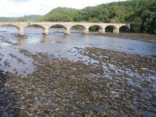
 This week the Dordogne river in front of the chateau dropped to an all-time low --- well, to be exact, to an all-time-since-I-arrived-here-low, which is of course not an all-time low in the truest sense...
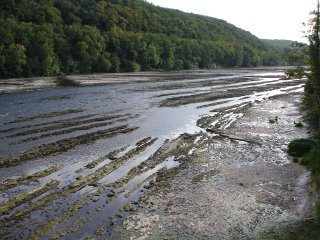
Anyhow -- after having posted pics of the river in full flow, swollen and powerful and deep, it is quite fascinating now to also see the bottom of the river bed. Deep grooves and ridges and long strata of water-eroded rock. Only down the centre of the river is there still a strong fast-flowing stream which, judging by the height of the rock strata, must be at least three meters deep. One can understand quite easily now why Lalinde has, since beginning of time, been such a strategically important spot on the river and regarded to be the only place where, when the water is low at this time of the year, the river can be forded without the help of a bridge.
Waterlevels of the Dordogne River rise and fall frequently in the Dordogne. It is customary for the water to be at its lowest in August, when the average flow in La Roque Gageac is 20 m3/sec; when the river is in spate in the spring, as we have often seen it! -- when it can rise to as much as 2500 m3/sec. The longitudinal gradient of the river is approximately 0.5 m/km. A log floating in the river can reach speeds of 50 kmh/31mph when the river is in spate -- most assuredly Fast Water!
 The geography of the Dordogne river is interesting: the river arises on the flanks of Puy de Sancy (1 886m/6 186ft) in the mountains of Auvergne, crosses five departments (Puy de Dôme, Corrèze, Lot, Dordogne and Gironde) and flows mostly west about 500 km in the Limousin and Périgord ,regions before it joins the Gironde river with which it shares a vast estuary with the Garonne river north of the city of Bordeaux.
 Although there are those who dispute the origins of the name Dordogne -- surprise! it is generally believed that the river takes its name from the names of two torrential streams called the Dore and the Dogne that meet on the flanks of Puy de Sancy and join there to form the Dordogne River. Another school of thought claim that the name Dordogne has evolved from the Celtic words Du unna meaning fast water. During the Roman Empire, the river was known as the Duranius, which gradually during the Middle Ages evolved to Duranna, Durunia, Durdunia, Dordoigne and finally Dordogne. As the speed of its flow never ceases to amaze me, I tend to think I would be in this second school of thought. Du unna - Fast Water it is for me! As mentioned, the Dordogne runs through five départements of France. Some of the towns on or near the river itself in those départements are:
The département of Puy-de-Dôme - the towns of Mont-Dore (near the source of the River), La Bourboule
The département of Corrèze - the towns of Argentat and Bort-les-Orgues
The département of Lot - The town of Souillac
The département of Dordogne - The towns of Beynac-et-Cazenac, Sarlat, Saint-Cyprien, and Bergerac - and of course Lalinde
The département of Gironde - the towns of Sainte-Foy-la-Grande and Libourne
The main tributaries which feed into the river along its 475km/296-mile course are
the Rhue
the Maronne
the Cère
the Vézère along which many of the great prehistoric caves of southwest France are located
and the Isle
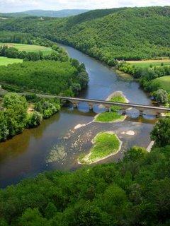
As the many caves attest, mankind - and in particular Cro-magnon Man, has existed on the banks of the river since pre-historic and ancient times. Remains from the Celtic period (3C BC) have been found in the middle section of the valley, while amphorae once used for wine have been uncovered in the region of Bergerac; these amphorae date from the 1C-2C BC and bear witness to a wine trade with Ancient Rome before vines were planted along the banks of the river.
There are some very important vineyards along the river Dordogne valley. A few of those are
Vin de Domme
Pecharment
Monbazillac
Saint Emilion
Pomerol
 In this blog we have spoken at length about the barrages or dams that are on the river -- in fact, a total of 18 of them. There is still the debate raging about whether these should be maintained or destroyed. The jury is still out on this one. The biggest dams are Bort les Orgues (built in 1951), Marèges (built in 1937), L'Aigle (built in 1945), Le Sablier (built in 1958) and Du Chastang (dating back to 1952), which all contribute to regulate the water level in the river and produce hydro-electricity.
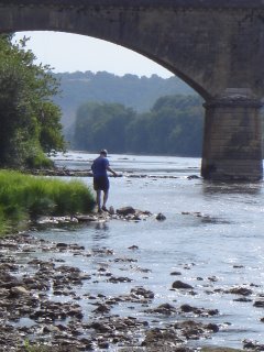
The Dordogne was twinned with the Jacques-Cartier river in Quebec in 1985 --- both rivers are involved in projects to re-introduce the Atlantic salmon into their waters. At the moment one is not allowed to fish for salmon, but there are at least nine other good edible fish in the river -- and ample of those too! We put a couple of rods in the water this past week right in front of the chateau and pulled out no less than three large carp in less than thirty minutes -- and that on a dry line and a trout fly!
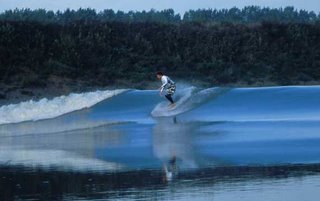 One of the fascinating things about this river, is that it is one of the few rivers in the world that exhibits the phenomenon known as a tidal bore.
 The tidal bore or eagre is a tidal phenomenon in which the leading edge of the incoming tide forms one or more waves of water that travel up a river or narrow bay against the direction of the current. As such, it is a true tidal wave -- and not to be confused with a tsunami. The word bore derives through Old English from the Old Norse word bara, meaning a wave or swell.
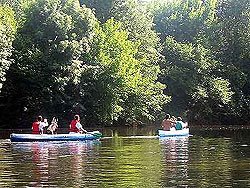
Bores occur in relatively few locations worldwide, usually in areas with a large tidal range (typically more than 20 feet between high and low water), and where incoming tides are funnelled into a shallow, narrowing river via a broad bay. The funnel-like shape not only increases the height of the tide, but it can also decrease the duration of the flood tide down to a point where the flood appears as a sudden increase in the water level. Bores take on various forms, ranging from a single breaking wavefront—effectively a shock wave—to ‘undular bores’ comprising a smooth wavefront followed by a train of solitary waves or solitons. Larger bores can be particularly dangerous for shipping, but also present a challenge to surfers.
The bore corresponds to a tidal wave that appears at the same time that the tide comes up -- right at maximum low, incoming. The differential of the water level only increases if the water flow profile permits the wave to "expand", and then to break when the water level becomes sufficiently low. The river must present an estuary, a progressive narrowing and the slope of the banks mustn't be too strong or too weak, and the amplitude of the tide must also be of sufficient force. It's actually pretty rare to have a river or channel produce rideable waves.
The most famous spot for bores on the Dordogne is at St. Pardon, which is a two-mile stretch, about 150 kilometers upstream from the ocean, that is famous among kayakers and surfers. At this point, the bore moves at about 24 km.p.h -- so just imagine a set of waves that goes slowly up the river, petering out as they move upstream. They look similar to ocean waves, but the intervals between waves are super short -- like 1- to 4 seconds, as opposed to an Indian Ocean 20-second interval groundswell. So even though you may have a waist high wave, it actually isn't even close to as powerful as an ocean-based waist-high wave. Nevertheless, it is nature, and as the waves move upstream, the riverbanks are swept clean of anything not firmly rooted or tied down -- branches, tree trunks and bits of wood twirl around the river after the waves move through.
In order for the bore to break, the tidal difference needs to be pretty extreme --which, as we see now, is not uncommon in this region of the world, and above all, the water level of the river needs to be relatively low. Those low water periods start in June if the spring is dry or in August if the spring and summer are humid; generally, the season finishes in October with heavy autumn rains but can extend to November if like this year, there's little precipitation. Another factor to consider is the wind: a strong N/NW wind can increase the size of the wave and also advance the hour of passage while a SE wind could cause the opposite.
For you consistency junkies, (yup! I know you are out there amongst my blog readers!) there are about 6 rideable days per month; and with two tides a day, that makes about 12 sessions a month unless of course the hours of passage happen to be at night. Well, there are a few who will ride the bore at night, but it's not exactly like mechanical precision, and should not be attempted by novices.
For example -- the hour of passage at Libourne, even if it is fixed on a tide table, changes according to a vast number of criteria. First, the real tide hour at the mouth changes according to the atmosphere's pressure, which is not foreseeable. Secondly, according to the level of the water in the river, the bore progresses more or less slowly. When the level is low, the progression of the wave slows down, so the bore is late. Patience! It has never been on strike. Thirdly, the wave rebounds on the banks and coils up in the bends -- so at the same place of the river, one day the wave will break on the right, and one the next day on the left. Like a billiard ball, the wave rebounds on each side of the banks. If this gibberish doesn't mean anything to you, just remember that the phenomenon changes according to many variables and that it's as fleeting as ocean waves (--or go study a surfer's website!).
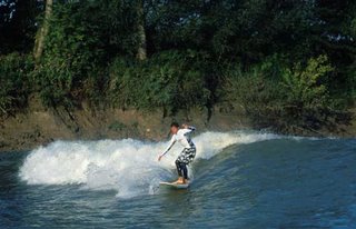
The long section of bore that's at St Pardon draws all the curious and regular visitors of this weird and wonderful phenomenon. Kayakers have been coming here for 20 years to try to beat their record or to find a place on the 400meter wide bore. On the nice days in August and September, it is not unusual to see up to 100 wannabe bore surfers, on kayaks, wave-skis, longboards and sometimes even on bodyboards. About half of them don't catch the wave -- not well placed, too slow, unsuitable board, etc. The other half make an incredible human chain. Everyone has a good time before, during and after, when bars and bistro's welcome without distinction those who have been dropped or picked up. Go to the "Cafe du Port" -- there are loads of wave photos. Those who have filmed can show their film on big screen.
I have it on authority that the scenario is sort of like this: surf the first section downstream, get out of the river while the level of the water can permit it, jump in a car ready to go, fly by to catch and get ahead of the bore, get back in the water upstream and try to catch a new section. Between the car full of mud, the danger driving in a record time and the live hazards, it's a little better to go by boat.
As for the floating branches and trunks? Well, you are sure to manage to weave in and out them.
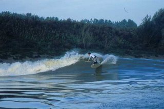 If that is enough to get you hooked on bore surfing, the world is your oyster! In Europe, the English have been riding the Severn Bore near Bristol since Colonel Churchill became the first "tidal bore rider" in 1955! Between the official record of Dave Lawson in 1996 of 9.12 miles and Steve King's unofficial one (19.76 miles), we don't really know, but the English do hold the record, even making the Guinness Book of World Records.
 Apparently -- and this still on authority! --- in 1998, an English expedition went on the Quientang River in China to attempt to ride a six-foot foam wave that they only managed to surf for 11 seconds before the "Silver Dragon" swallowed one of the Zodiacs. There's also the Turnagan Arm near Anchorage in Alaska, offering goods rides in a snowed up mountain decor, and the Amazonian "pororoca", which some claim can reach up to 12 feet. A competition is organized each year in March at Sao Domingo Do Capim in Brasilia, and it's the Rio Araguari in the Para is the focus of Brazilian big-wave bore riders. Noelio Sobinho, who's surfed 30 pororocas since pioneering the sport in Brazil in 1997, holds the record there with a 16 minute and 39 second ride at Marajo.
Click on Link:
Chateau Lalinde : The perfect venue for your event
TAGS: Events Rent a chateau France
Chateau
Perigord Food Holidays in France Recipes


